

 Detailed Description of the current Version
 Descriptions of the GeoDLL Function Groups
 User Manual with all Function Descriptions
 User Manual searching for expressions
 List of Coordinate and Reference Systems
 Download of the supported NTv2 / HARN grid files
 Programming example
 Group Prices GeoDLL
 Click here to
 Click here for the
GeoDLL supports the development of geodetic software by providing geodetic functions, which are put together into function groups for specific tasks. To use user defined coordinate transformations in own developments a license for the function group "User Definitions" can be purchased.
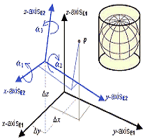
The group "User Definitions" contains functions for the input of the parameters of self defined Coordinate Systems, geodetic Reference Systems and earth ellipsoids which can be used with the functions of the group "Coordinate Transformations" besides the predefined GeoDLL systems.
Detailed descriptions of all geodetic functions of this function group you find  here in the Online Manual!
 In order that you are always well informed about our company, we write actual news, current information and special offers here into this column.
 Service and Maintenance...
 Description ORTWIN...
 Description TOPOWIN...
 Read more...
 Read more...
 Register now...
 Read more...
 Read the work sheet...
 Read the work sheet...
 Read the work sheet...
 Read the Press Release...
 To the NTv2 collection...
