Killet GeoSoftware Ing.-GbR - short: KilletSoft - is a software company, which was established in the year 1991.
The society is divided into the ranges "Geodetic Standard Software", "Development Tools for Geoinformatics" and "German Geodata".
The focal trades of the companies supplied by KilletSoft are consulting engineers, GIS developers, Internet marketing, public utilities, logistics, telecommunications, security and public services.
GeoDLL - Geodetic Development Kit
Function group "Coordinate Transformations"
GeoDLL - Accurate Coordinate Transformations
GeoDLL supports the development of geodetic software by providing geodetic functions, which are put together into function groups for specific tasks.
To use accurate coordinate transformations in own developments a license for the function group "Coordinate Transformations" can be purchased.
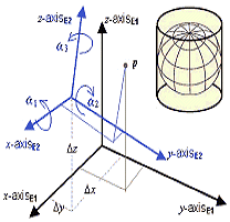
GeoDLL performs Coordinate Transformations fast and with high accuracy.
For this purpose the DLL supports thousands of worldwide Coordinate Systems, geodetic Reference Systems, Reference System Transitions (geodetic datum shifts) and Meridian Strip Transitions.
Additional the software supports User-defined Systems, 2D/3D transformations, Extra Parameters like Meridian Convergence and Origin Center Meridian, INSPIRE, NTv2, HARN, EPSG, GPS, Continental Drift and much more.
Characteristics of the group "Coordinate Transformations"
- Coordinate Transformation
- Reference System Transition
- Meridian Strip Transition
- 2D and 3D Coordinate Transformation
- Helmert and Molodensky Reference System Transition
- NTv2 and HARN grid file support
- Forward and backward transformations
- Numeric and alphanumeric coordinates
- Geographic and Cartesian coordinates
- Many projections (also rarely used ones)
- Thousands of predefined systems
- Use of EPSG codes
- Use of Measurement Units
- Calculation of Meridian Convergence, Origin Center Meridian, Geographical Point
Functions of the group "Coordinate Transformations"
- Function coordtrans() - 2D Coordinate Transf. / Datum shift, num. / alphanum. (char**)
- Function coordtrans2() - 2D Coordinate Transf. / Datum shift, num. / alphanum. (char*)
- Function coordtrans3() - 2D Coordinate Transformation / Datum shift, num., with notation
- Function coordtrans4() - 2D Coordinate Transformation / Datum shift, num, without notation
- Function coordtransex() - 2D Coordinate Transf. / Datum shift, reduced eastings
- Function coordtrans3d() - 3D Coordinate Transf. / Datum shift, num. / alphanum. (char**)
- Function coordtrans3d2() - 3D Coordinate Transf. / Datum shift, num. / alphanum. (char*)
- Function coordtrans3d3() - 3D Coordinate Transformation / Datum shift, only numeric
- Function coordtrans3d4() - 3D Coordinate Transformation / Datum shift, only numeric, no notations
- Function coordtrans3dex() - 3D Coordinate transform. / Datum shift, reduced eastings
- Function coordtransepsg() - EPSG code Coordinate Transformation / Datum shift
- Function meritrans() - Meridian strip change with GK und UTM coordinates
- Function setcoordarea() - Coordinate System range check on / off
- Function setcalcextra() - Calculation of extra parameters on / off
- Function coordcalcextra() - Calculation of extra parameters during coordinate transformations
- Function coordcalcextraind() - Calculation of extra parameters independend of coordinate transformations
Ausführliche Funktionsbeschreibungen
Detailed descriptions of all geodetic functions of this function group you find here in the online manual!

In order that you are always well informed about our company, we write actual news, current information and special offers here into this column.
pur
 Geodata Germany
All databases has been updated to the data conditions of January 1st, 2024.
The georeferenced databases contain all German towns, municipalities and urban districts, coordinates, postal codes, dialling codes, administrative units, nature areas, landscapes, travel areas, wind and snow loads, solar irradiation, cartographies info etc.
 Read more...
New work sheet
Display Formats of UTM Coordinates.
Display formats, calculation methods and the historical background of the UTM coordinate system.
Third revised edition of the popular technical article.
Read the work sheet...
New work sheet
What actually is a Coordinate Reference System?
Explanation of the Coordinate Reference System with the components Coordinate System, Reference System, Reference Definition and Reference Frame.
Second revised edition.
Read the work sheet...
Illegal software versions
The illegal use of our software got out of control!
Read our Info...
is member of

Translators wanted!
The programs TRANSDAT, SEVENPAR, NTv2Creator, NTv2Poly and NTv2Tools support language files for the programs interface.
Since the language dependent texts are managed in external files,
new languages can be added at any time by creating new language files.
Everybody who is interested can translate a new language file into his native language for himself and all users.
Author: Dipl.-Ing. Fred Killet
Page name: p_gdlfkt_e.htm
Page views: 87
Period: since Januar 1, 2024


 Detailed Description of the current Version
 User Manual with all Function Descriptions
 Download